


Nautical Calculator
Nautical Calculator açıklaması
Nautical Calculator, kerte çizgisini ve harika daire navigasyonunu hesaplayan bir Android uygulamasıdır.
Uygulama tamamen ücretsizdir.
Ana işlevler şunlardır:
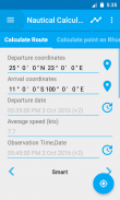
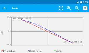
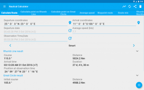
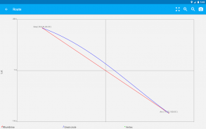
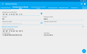
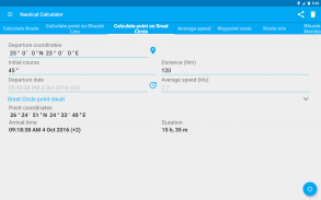
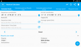
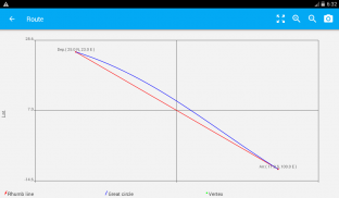
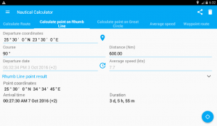
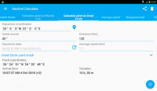
- Verilen iki koordinat, büyük daire ve kerte çizgisi rotaları, mesafeler, büyük daire köşe ve meridyen kısımları hesaplanır, grafikleri gösterir.
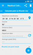
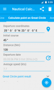
- Bir pozisyon verildiğinde, rota ve mesafeler için ilerletilerek yeni pozisyon belirlenir.
- Wheel Over hesaplaması
- Pusula algılamaları
- Taslak anket
- Dönüştürücü
- Yarar
diğer özellikler etkinleştirilebilir.
- Ortalama hızı hesaplayın
- E.T.A. hesaplama
- Manuel yol noktaları planlaması için rota planı
- Ara nokta rotası
- Paralel limitli rota karışımı
- Rhumb Line Paralel/Meridyen kesişimi
- Aynı Rhumb Line rotasını takip edin
- Karşı kurs randevusu
- Rota düzeltme
- Gün batımında ve gün doğumunda Genlik hesaplayın
- Pusula Hatası
- Drift sorununu çözer
- Gelgit problemini çözer
- Gelgit akımı sorununu çözer
- Omurga altı açıklığı problemini çözer
- Beaufort sınıflandırması ile rüzgar hesabı
- ABC Tabloları (azimut, başlangıç rotası, bilinmeyen yıldızla doğru yükseliş)
- Denizcilik almanak
- Ayın evreleri
- Konum çizgisi ile Göksel Navigasyon
- Meridyen geçişi
- Gök gözlemi
- Kıyı navigasyonu
- Çarkıfelek
- Taslak Anket
- Dönüştürücü
- Demirleme
- İnterpolasyon
Güzergah özelliğinde bir dünya haritası vardır: bir deniz haritası değildir ve bir satış haritası olarak kullanılmaz, ancak dünyadaki sudaki rotaları göstermenin basit bir genel yolu olarak, bu harita navigasyon amaçlı değildir. .
facebookta takip et
https://www.facebook.com/NauticalCalculator
Nautical Calculator - Sürüm 11.0.2
(18-01-2025)Nautical Calculator - APK Bilgisi
APK sürümü: 11.0.2Paket: com.gabrielegi.nauticalcalculationNautical Calculator uygulamasının en son sürümü
Diğer sürümler


Aynı kategorideki uygulamalar


